
Project Overview
This land was initially identified for residential use when the Scripps Miramar Community Plan was adopted in 1978. Our desire to pursue a residential project is consistent with this early vision. While the original community plan focused on senior housing and estate lots, today’s housing needs are geared towards entry-level attainable housing. Despite the evolved demographics, the importance of community character, quality, and connectivity are just as relevant today as they were back then.
Although a product type has yet to be determined, we anticipate this new neighborhood could yield up to 450 market rate units plus 10% affordable housing units (or roughly 15-29 dwelling units per acre).

Community Context
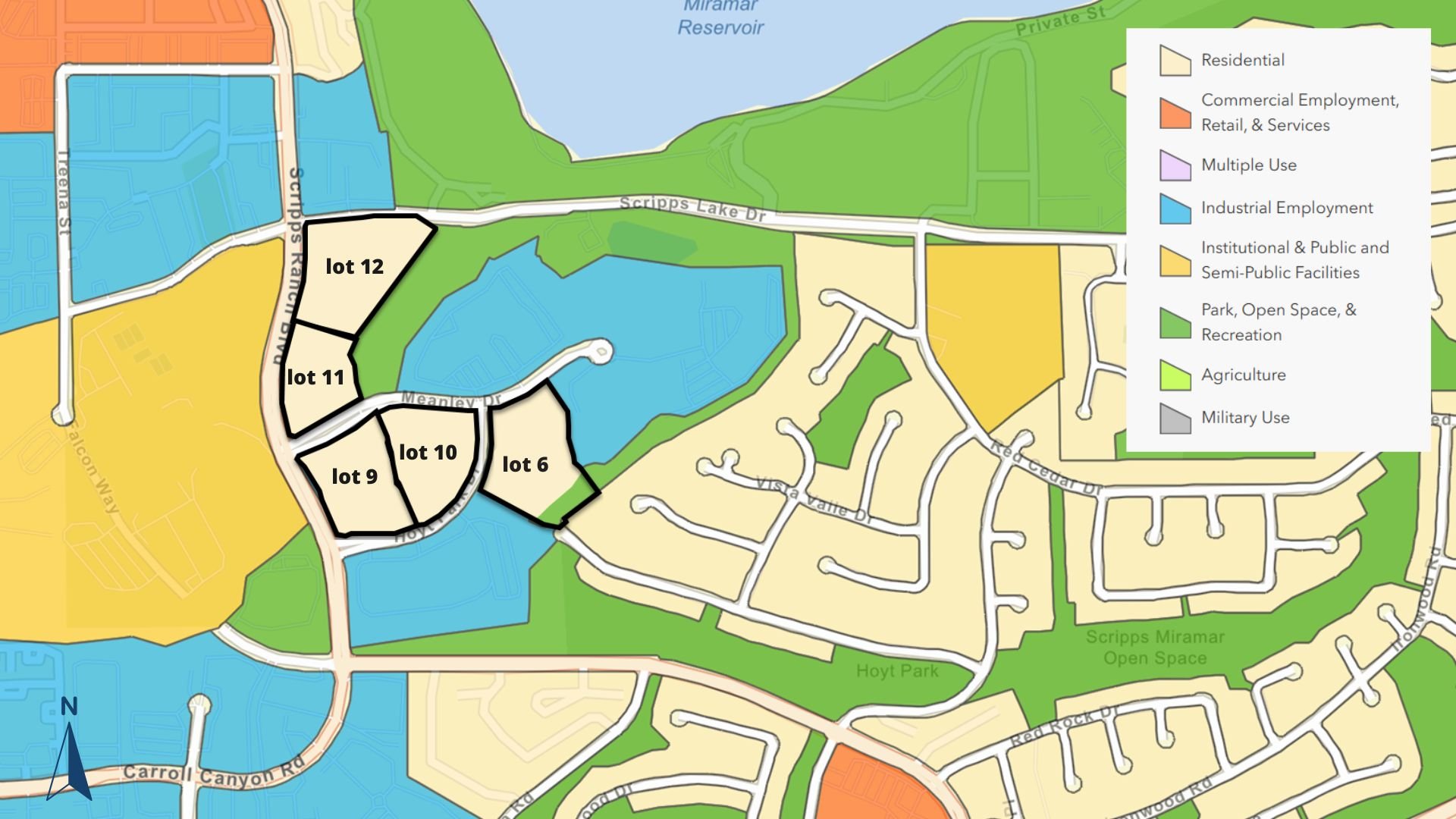
The project site is comprised of five parcels (lots 6, 9, 10, 11 and 12), totaling 23 acres. It is bordered by Scripps Ranch Blvd. and Scripps Lake Drive. Meanley Drive bisects lots 9 and 11.
Existing development in the area generally consists of office or light industrial uses to the north, Scripps Ranch High School to the west and residential to the east.
Community PLan Land Use Designation and Zoning
The project area was changed from residential to industrial use in 1986. A Prime Industrial Lands designation was also applied to this site. Other Prime Industrial areas around the county, like University City and Otay Mesa, benefit from proximity to universities and research hospitals, making them more ideal hubs for abundant Prime Industrial Lands. However, the Scripps Miramar Ranch Community lacks these ancillary uses so it is not as naturally aligned to support Prime Industrial development - which is why these parcels have failed to attract investment.
Additionally, “sensitive receptors”, like schools, libraries and parks, have encroached into the Prime Industrial area, further decreasing these parcels’ ability to bring in an Industrial user.
This project site is currently designated Industrial/Employment (pictured left). The city’s complete Zoning and Parcel Information Portal can be accessed here. This application requests that designation be changed to Residential (pictured right).

Existing - Industrial Land Use Designation (Excerpt from City of San Diego Zoning and Parcel Information Portal. Link above.)
Proposed - Residential Land Use Designation
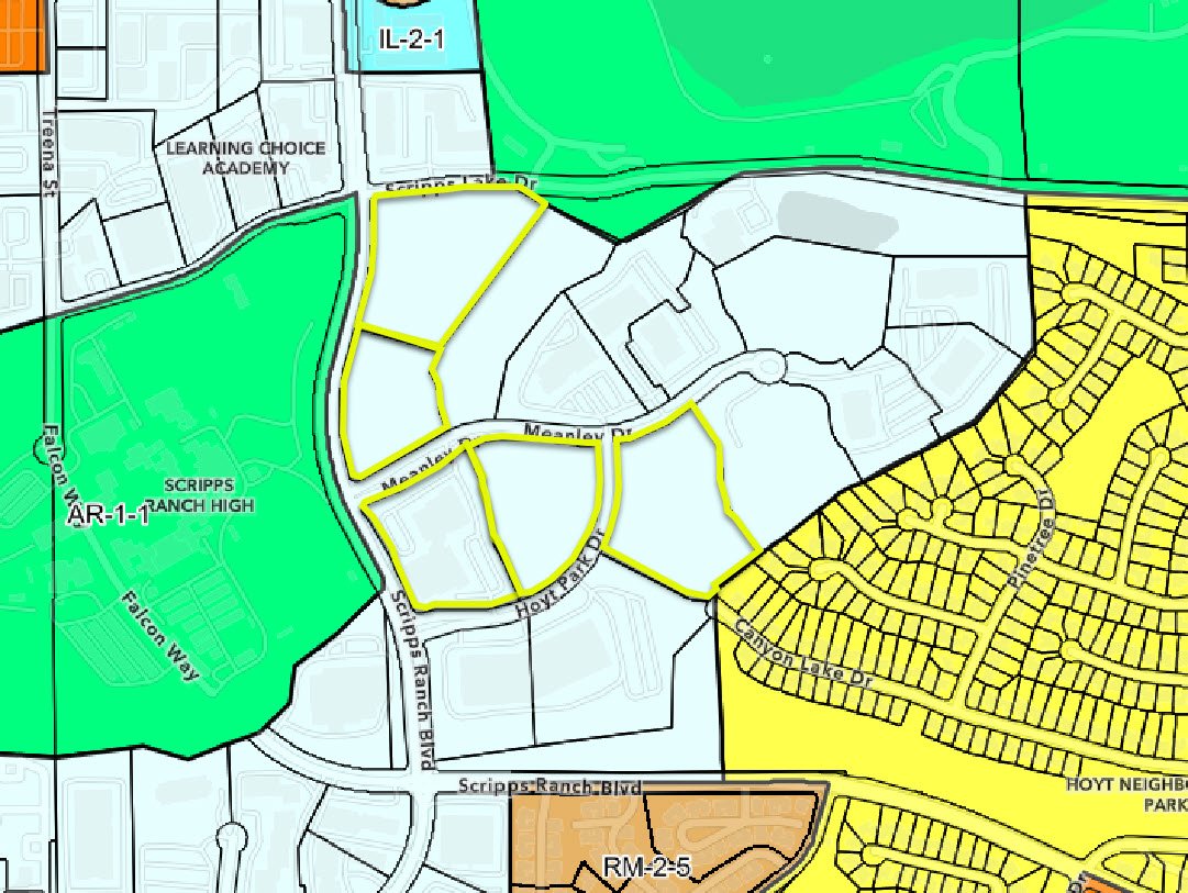
Existing Zoning - Industrial Park (IP-2-1. Excerpt from City of San Diego Zoning and Parcel Information Portal. Project boundaries added for clarity. Link above.)
The site is currently zoned IP-2-1 (Industrial Park). A new residential zone will be requested once site planning is complete. Site planning is underway!